Alabama: Its Landforms and Natural Features
Winner of the 2018 NACIS Student Map Competition for Best Design
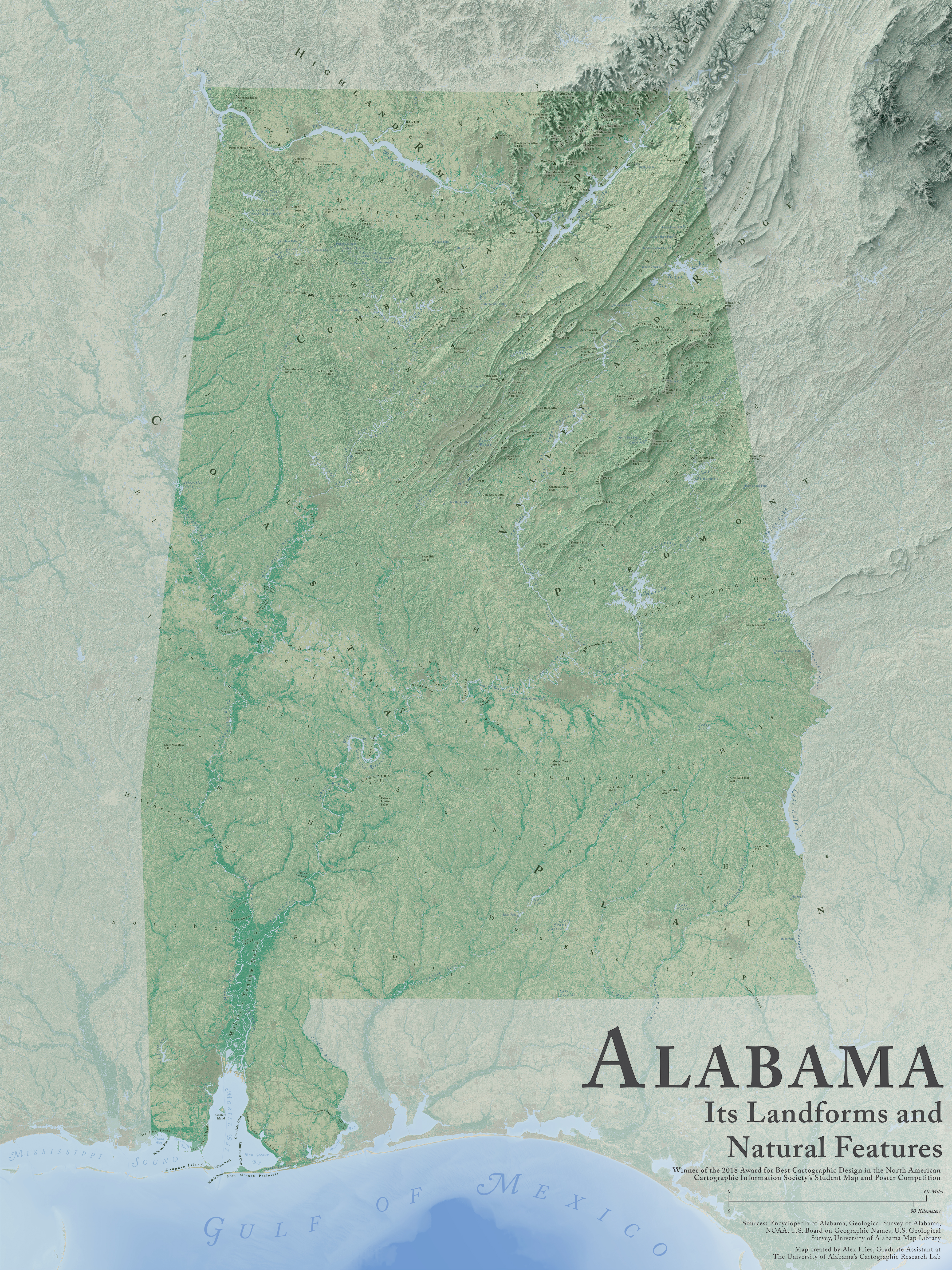
One of the maps that ultimately inspired me to become a cartographer in the first place was Daniel Huffman's wonderful terrain map of Michigan. Though the map was technically "just" a draft when I stumbled across it in late 2016, I personally found it to be one of the most breathtaking pieces of cartography that I'd ever laid eyes on. And after I spent what must have been hours simply pouring over it, analyzing and admiring every contour and river course and feature label that I could find, I toyed with a simple thought for a short moment: why not make a map like this of Alabama? By this point in my life, I'd learned much about Alabama's unsung natural beauty, so I thought that it could be the perfect subject for a similarly-styled map. But the moment quickly passed and I let the thought (mostly) escape with it: the reality was that, at the time, I simply didn't have the design or technical knowhow to take on such a project.
A year and a half later, though, I decided to take the plunge and make the map of Alabama that had crossed my mind many times since I first came across Daniel's blog post. No doubt, my decision to make the map in the last semester of my undergraduate career at the University of Alabama was also influenced by the fact that I'd been given explicit permission to do something cartographic for my final project in Advanced Remote Sensing. But it didn't take long after I'd started working on the map for me to realize just how daunting of a task it would turn out to be. Indeed, it was the first project I'd ever taken on that involved the careful processing, editing, blending, visualizing, and labeling of so many different data layers—and all the same, never before had I worked on a map that spanned an entire state at such a relatively fine scale!
It took months of grueling work and learning completely new techniques for processing and manipulating data properly in QGIS, Blender, Photoshop, and Illustrator (not to mention labeling the map, which proved to be a monumental task in its own right), but I was indeed eventually able to complete the map to a standard that satisfied the mental versions of it I'd spent many months imagining in my head. As these things tend to work, too, the map-making process itself became a natural vehicle for me to learn even more about the state of Alabama, and in turn I found myself falling more and more in love with a place that I had once dreaded. (Side note: if you'd like to read more about this particular facet of my map-making journey, feel free to check out my post on A Cartographer's Story found at this link).
At the end of the day, though, I consider this map to be a perpetual work-in-progress: there are many prominent and magnificent natural features that I simply missed when labeling it the first time that I'd like to eventually add to the map—a side effect of taking on the mapping of an entire state, I suppose. I'm also interested in someday updating the land cover to more recently-released datasets that are able to tell the story of Alabama in an even more profound manner—for example, I hope to use the map as a way of highlighting areas in the state that have been devastated by tornadoes in recent years, including the very city I'm sitting in as I type this page out. At the end of the day, though, much as Daniel's map of Michigan served as a love song to his home, this map of Alabama is my sort of love letter to the state I've long called home—and I hope you can enjoy the map as much as enjoyed the process of making and sharing it.